

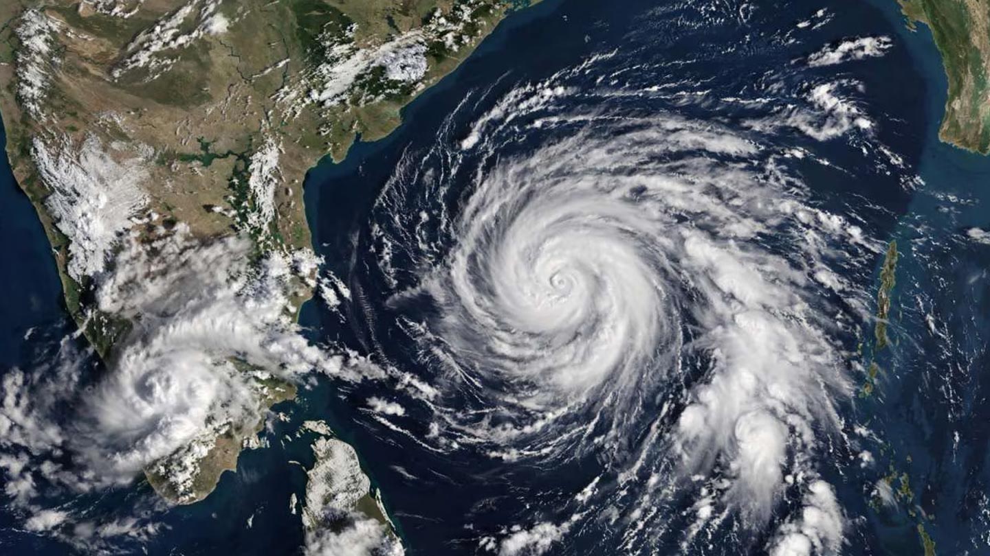
BHUBANESWAR / VISAKHAPATNAM – A weather system churning over the Bay of Bengal was expected to become a cyclonic storm on Monday, Oct. 26, prompting warnings along India’s east coast and putting authorities in Odisha and Andhra Pradesh on alert ahead of a projected landfall in the early hours of Wednesday, Oct. 28.
The India Meteorological Department (IMD) said in an update issued on Oct. 24 that a well-marked low-pressure area over the east-central Bay of Bengal was set to concentrate into a depression that day, become a deep depression on Oct. 25 and develop into a cyclonic storm over the west-central Bay of Bengal by the morning of Oct. 26. The system is then expected to move west-northwestwards and reach the coast near north Andhra Pradesh and adjoining south Odisha early on Oct. 28.
How strong will it get?
Forecasts have grown more serious as the system has organized. Kalinga TV, citing the IMD bulletin, reported on Oct. 26 that the storm could strengthen into a severe cyclonic storm by the morning of Oct. 27, with sustained winds of 115 to 125 kmph and gusts of up to 140 kmph around landfall. The IMD has issued an orange message cyclone alert for Andhra Pradesh and the adjoining south Odisha coast. Reports indicate the storm is expected to be named Arnab, a name proposed by Bangladesh under the region’s rotating list.
Forecasters expect the effects to reach beyond the landfall zone. The IMD predicts heavy to very heavy rainfall at a few places over coastal Odisha, and isolated heavy rainfall over coastal West Bengal, on Oct. 27. Thunderstorms with gusty winds of up to 40 kmph are forecast across south Bengal districts from Oct. 28, according to The Federal. Fishermen have been advised not to venture into the sea from Oct. 26.
Preparations on the coast
Odisha, which has built a reputation for disaster preparedness since the catastrophic super cyclone of 1999, is again moving to a high-alert footing. District administrations typically pre-position relief material, cancel leave for officials and prepare evacuation of low-lying and coastal areas ahead of such storms, and the state government has drawn on that playbook for earlier cyclones. In Andhra Pradesh, officials are watching the coastline from Visakhapatnam to Srikakulam and nearby districts, where the storm is forecast to make landfall.
The approaching storm has already altered some official schedules. President Droupadi Murmu’s two-day visit to Mayurbhanj in Odisha, originally planned for Oct. 28 and 29, has been rescheduled to Nov. 4 and 5 because of the cyclonic storm threat. Prime Minister Narendra Modi’s visit to Odisha on Oct. 25 to inaugurate an RBI data centre in Khordha went ahead as planned.
A regional weather event
The impact is likely to be felt well beyond India. In Sri Lanka, the Financial Times reported on Oct. 24 that the Bay of Bengal system would become a cyclone by Monday with no direct impact on the island, and the Daily Mirror said on Oct. 26 that the developing cyclone would affect the country only indirectly. Across the Himalaya, the Kathmandu Post reported that the system could bring rain and even snow to parts of Nepal next week, a worrying prospect for a country still grappling with the aftermath of devastating floods in September.
Bangladesh also has a stake in the storm’s track, both because of its proximity to the Bay of Bengal and because the cyclone’s name was proposed by Dhaka. Coastal districts there, as in West Bengal, are likely to experience at least rough seas and squally weather even if the core of the storm stays away.
What residents should expect
Coastal communities in the landfall zone can expect strong winds, storm surge, heavy rain and the possibility of flooded roads, damaged power lines and uprooted trees. Authorities typically urge residents to follow official bulletins, move away from low-lying areas when instructed, and avoid unnecessary travel. Rail, road and port operations can also be disrupted, and some may be suspended as the storm nears.
Meteorologists caution that the final track and intensity of a cyclone can shift in the last 48 hours. Forecasts issued on Oct. 24 projected a landfall near north Andhra Pradesh and south Odisha, but the exact location, timing and strength will become clearer as the storm approaches. The IMD has said it will issue regular updates, and officials in both states have urged people to rely on those rather than on unverified social media posts.
For India’s east coast, which has endured several powerful cyclones over the past decade, the lesson of recent storms is that early warning and rapid evacuation save lives. The next 48 hours will test those systems again.
Cyclone Arnab Takes Aim: Odisha and Andhra Pradesh Brace as a Bay of Bengal Storm Builds
- October 26, 2026
- TSA News
Cyclone Arnab Takes Aim: Odisha and Andhra Pradesh Brace as a Bay of Bengal Storm Builds
Tag :
Search Post
Popular Posts



Follow Us
Follow us on social media and never miss the latest updates, trending news, and exclusive stories.
0 Comments